m (Rdi dtes moved page Draft dtes 243027407 to Bfbba123-bb2c-11e8-844c-005056924a59c) |
|||
| (One intermediate revision by the same user not shown) | |||
| Line 1: | Line 1: | ||
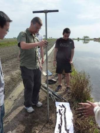
| − | [[Image:Draft_dtes_243027407-bfbba123-bb2c-11e8-844c-0050569-13-IGC_Delft.jpg_262887698.jpg|center| | + | [[Image:Draft_dtes_243027407-bfbba123-bb2c-11e8-844c-0050569-13-IGC_Delft.jpg_262887698.jpg|center|Treball de camp al delta de l’Ebre|frame]] |
| − | |||
'''Coordinació de l’activitat:''' Institut Geològic de Catalunya. | '''Coordinació de l’activitat:''' Institut Geològic de Catalunya. | ||
| Line 9: | Line 8: | ||
'''Altres participants:''' Delft University of Technology, Faculty of Civil Engineering and Geosciences. | '''Altres participants:''' Delft University of Technology, Faculty of Civil Engineering and Geosciences. | ||
| − | + | ||
==Objectiu:== | ==Objectiu:== | ||
| Line 21: | Line 20: | ||
</ul> | </ul> | ||
| − | + | <br /> | |
==Publicacions:== | ==Publicacions:== | ||
| − | Effrosyni Boufidou. 2011. | + | Effrosyni Boufidou. 2011. ''Towards Understanding the DOQ Priorat terroirs: a multivariate GIS analysis.'' Unpublished thesis. Delft University of Technolygy Faculty of Civil Engineering and Geosciences. Master of Science in Geomatics Program. |
<ul></ul> | <ul></ul> | ||
| − | <span id= | + | <span id="bloc1"></span> |
Latest revision as of 13:16, 10 May 2021
Coordinació de l’activitat: Institut Geològic de Catalunya.
Període: 2011-2013
Altres participants: Delft University of Technology, Faculty of Civil Engineering and Geosciences.
Objectiu:
Intercanvi d'informació i col·laboració en aspectes de: cartografia, geotècnia (tècniques de mostreig i laboratori), geofísica, riscos geològics, recursos hídrics, sensor remots i imatges de satèl·lit de Catalunya.
Descripció:
- Promoure activitats de docència i recerca en Enginyeria Geològica dins Catalunya.
- Intercanvi de informació i técniques d'estudi en Enginyeria Geològica.
- Promoure preparació i cerca de finançament per a projectes de recerca i desenvolupament.
Publicacions:
Effrosyni Boufidou. 2011. Towards Understanding the DOQ Priorat terroirs: a multivariate GIS analysis. Unpublished thesis. Delft University of Technolygy Faculty of Civil Engineering and Geosciences. Master of Science in Geomatics Program.
